Issue
In response to state legislation, the Florida Department of Environmental Protection needed to assess flood vulnerability—identifying the infrastructure, critical assets, and communities at risk of flooding and sea level rise—for the entire state. To complete this task on an aggressive timeline, existing data gaps in statewide coverage needed to be filled.
Process
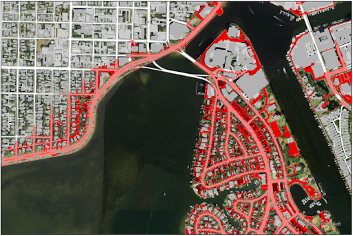
The Department of Environmental Protection partnered with Taylor Engineering, Jones Edmunds, and Fathom to conduct flood risk modeling. They incorporated data from NOAA’s Coastal Change Analysis Program (C-CAP) for impervious surfaces to more accurately represent the effects of urbanization on flood risk for Florida’s coastal areas. The high-resolution data enabled them to identify areas with dense impervious cover, assume the presence of urban drainage systems in those areas, and adjust the models accordingly. The models would have overestimated surface water flooding in urban zones without this detailed impervious mapping.
Impact
The department’s staff now has access to a statewide map showing the vulnerability to flooding of more than three million critical assets such as roads, rail networks, government buildings, critical infrastructure, and natural and cultural resources under current and future conditions. This information is helping the agency make crucial decisions on funding adaptation projects across the state.
By using the high-resolution C-CAP data, the team ensured their assessment reflects on-the-ground conditions and accounts for new urban development. Accurate, high-resolution data on impervious surfaces are crucial for coastal communities to assess changing flood risks and plan for a more resilient future. (2024)

